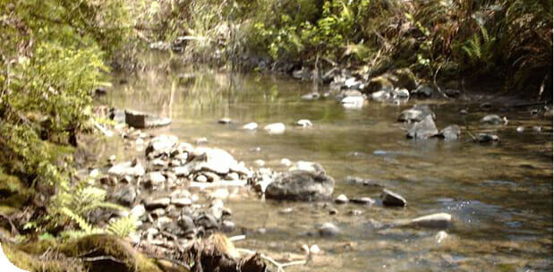
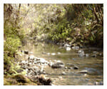
The Bureau of Land Management (BLM) retained LACO to investigate an active landslide affecting a nearly 400-foot section of the Headwaters Reserve Trail along the South Fork Elk River in Humboldt County, CA. Our team of geologists and GIS analysts conducted a field reconnaissance and analyzed LiDAR remote sensing imagery to characterize the subject slide and develop mitigation measures.
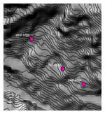
LACO’s GIS Team was instrumental in aiding the geologist’s field reconnaissance mapping and characterization of the large-scale landslide. The analysts converted a raw LiDAR point cloud into a geodatabase point feature class, populated the XYZ attributes and converted it into a LiDAR derived Digital Elevation Model (DEM) with sub-foot Z accuracy. Spatial Analyst Extension functionality was then used to convert the LiDAR DEM into a two-foot cell size hillshade map and generate 1 foot contours.
The hillshade and contour maps enabled LACO’s Geology Team to accurately define the size, boundaries, breaks, and toe of the active slide in the heavily vegetated terrain. The detail maps also enabled our Geology Team to accurately locate former skid roads and dive trails constructed during legacy harvesting activities and assess their potential contribution toward the destabilization of the hillslope. Using these maps, our Professional Geologist developed a strategy to minimize the potential for future landsliding by designing a drainage plan that included the re-contouring of the disrupted drainage network and the re-routing of surface runoff away from the head scarp of the slide to a suitable discharge location.
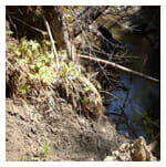
We also assisted the BLM in developing strategies for rebuilding a usable trail through the area affected by active landsliding, and mitigating additional sediment discharge negatively effecting salmonoid species that spawn in the South Fork Elk River.