The McKinleyville Service District (the District) and Humboldt County Department of Public Works (the County) retained LACO to analyze the amount and rate of erosion along the Mad River Bluffs. Located near the end of School Road in McKinleyville, these bluffs erode sediment during winter storm events into the mouth of the Mad River. Subsequent land recession threatens roads, existing structures, utilities, and properties. This analysis was needed to make an informed decision regarding what action response should be taken and when it should be implemented.
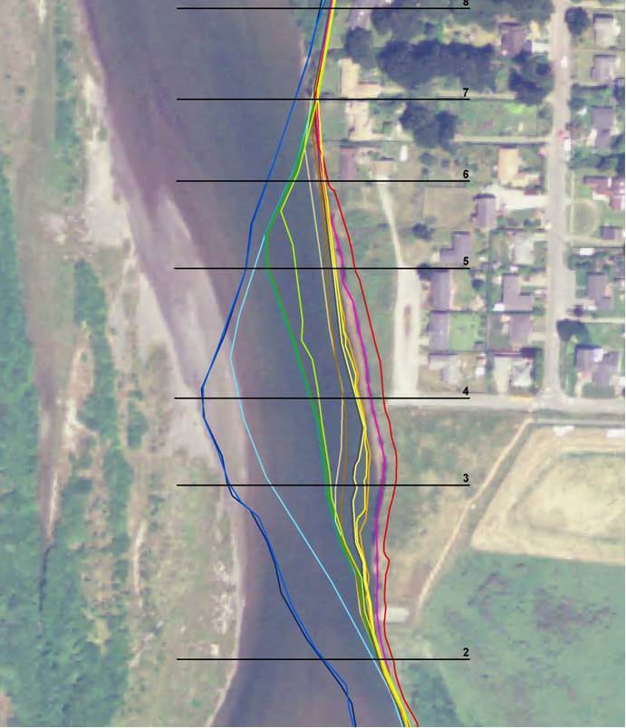
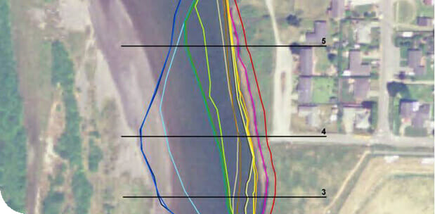
LACO’s GIS Department analyzed historic aerial photography in order to create five year average amounts and rates of recession. Since no formal tracking data or record was kept prior to the 1990’s, the GIS team used the aerial photographs to outline the recession. This project was complicated by the fact that each photo varied in color, quality, scale, photo center point (nadir), and none of them were georeferenced to a projected coordinate system or datum. The team selected photos from 1941 to present for quality and area of focus, then scanned them to high resolution dpi images. These images were then manually aligned with and georeferenced to State Plane coordinates to within a 5 foot standard of accuracy. The team then digitized the bluff edge lines to represent 13 sets of photo flights spanning six to three year intervals, which were then measured to determine the average amount and rate of recession.
Based on LACO’s GIS aerial photo time series analysis, several agencies determined that an emergency response to the slope failure was warranted. The findings allowed several agencies to secure government funding, streamline the permitting process through the Army Corps of Engineers, and obtain an emergency coastal development permit to begin bluff stabilization.